
This trail is a hidden gem in Northland, offering an authentic New Zealand experience that is arguably one of the finest in the region. During our journey from the Bay of Islands to the Karikari Peninsula, we made a stop at this location in November 2017, on a sunny and tranquil day. Looking back, I regret not having spent more time here, as it was one of the most serene and breathtaking places we encountered during our six-week trip.
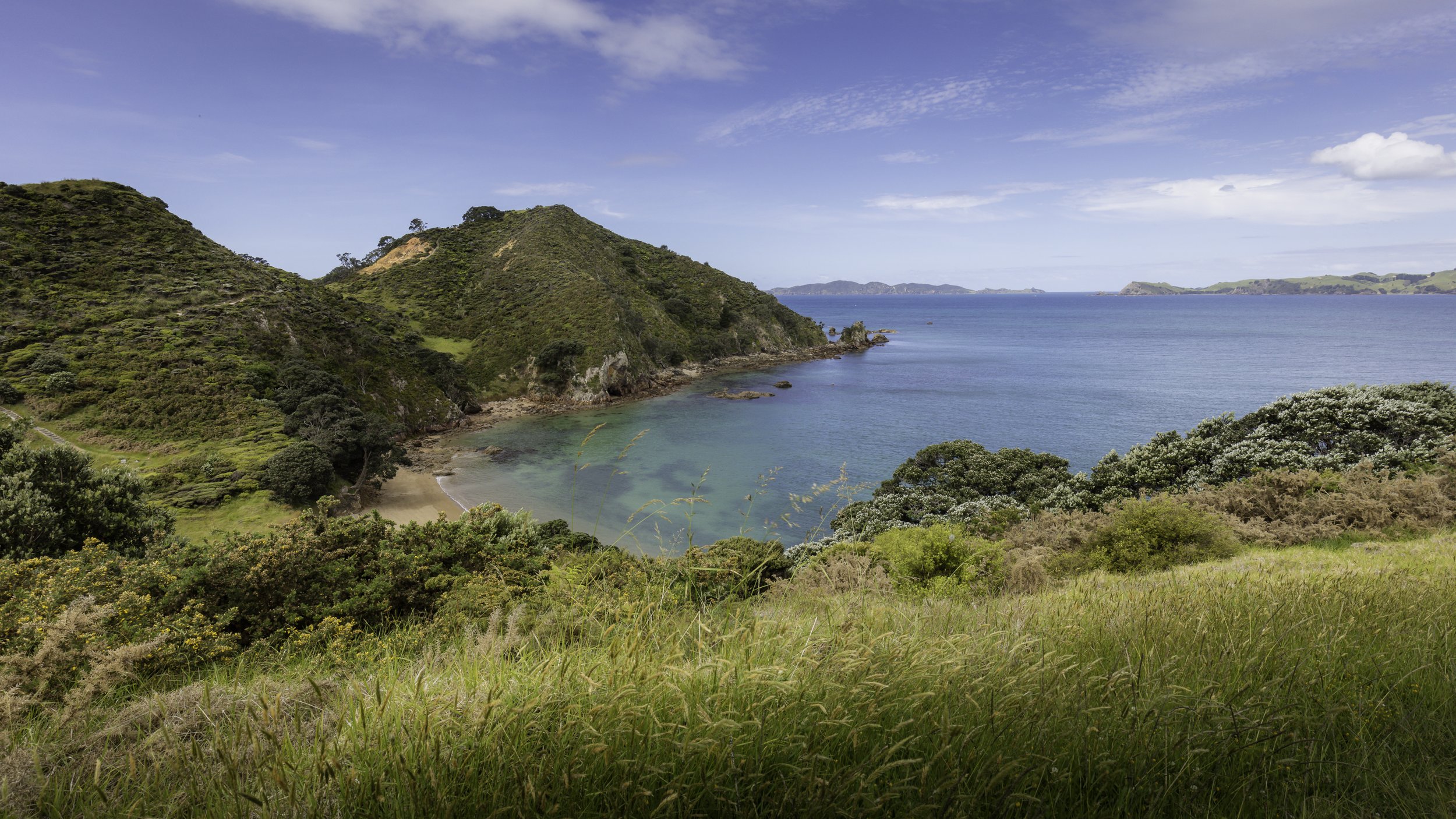
The Mahinepua Bay has a parking lot (Google coordinates: -34.99918 173.843550) where visitors can access the track that follows the Mahinepua Peninsula as it extends into the Pacific Ocean. The Northside of the Peninsula offers a rugged sea, rocky beaches, and sea stacks, while the southside is more sheltered and has sandy beaches. The track is approximately 3km long (one way) and takes about an hour to reach the head. However, you will likely take longer due to the spectacular 360° panorama views. The track is well-developed and moderately challenging, with an elevation gain of around 250m due to the ups and downs. The highest point of the trail is approximately 62m above sea level. On a clear and sunny day, the peninsula has plenty of stunning beaches to explore, and visitors can often have them to themselves. What makes this location truly special is its lack of tourism compared to the Bay of Islands, despite offering views that are equal, if not superior. I was taken aback by the area's natural beauty and would love to return for a longer stay.
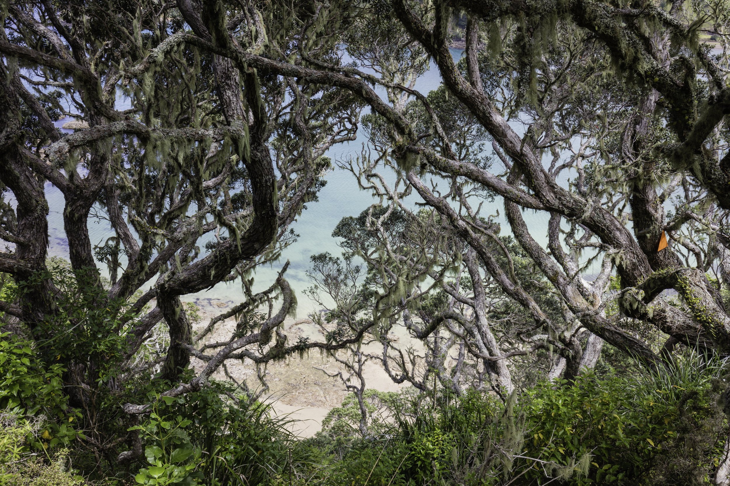
Landscape photographers will be spoiled for choice as there is no shortage of subject matter. It's a shame that we didn't have an overnight stay here, as I'm certain that it's a fantastic location for both sunrise and sunset photography. The location offers great views to both the west and east for seascape photography, with gnarly moss-covered trees that loom over the sea, huge ferns, and other tropical vegetation.
Regarding gear, I recommend bringing the "holy trinity" of lenses (wide, normal, and telephoto) if possible. If you want to travel light, a versatile travel lens (such as a 24-200mm) is a good choice.
Recommended lenses:
wide-angle zoom (eg: 16-35mm) - must have
normal zoom (24-70mm) - must have
telephoto zoom (eg: 100-400mm) - must have
Recommended equipment:
Tripod - must have
ND Filter - must have
Polarizer - must have
MAP:

Points of Interest:
North-Shore
South-Shore
Head (Omiriu Trig)
North-Shore
As we venture along the elevated track, we are treated to a breathtaking vista of the rugged coastline, replete with rocks and small sandy beaches. To the west, one can catch a glimpse of the majestic sea stacks, known as Frenchman Rock, rising up from the deep blue waters, and the distant Stephenson Island adds a touch of intrigue to the already enchanting scene. The shoreline is enveloped by an abundance of lush tropical vegetation, which, although not towering in height, provides a verdant carpet of green that perfectly complements the rugged terrain.


South-Shore
This side of the peninsula offers a respite from the rugged Pacific Ocean, with calmer waters and expansive, gently curved sandy beaches that boast a lighter hue. The landscape is dotted with larger trees that rise up to block the view towards the south.


The Head (Omiriu Trig)
Upon reaching the end of the track, a noticeable shift in vegetation can be observed, as the ground becomes covered in a rich, red sandy earth. In the northeast direction lie two captivating islands, Motueka and Mutuekaiti, each with their own unique characteristics and natural wonders waiting to be discovered.


